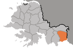
Paechon County
Paech'ŏn County
배천군 | |
|---|---|
| Korean transcription(s) | |
| • Hanja | 白川郡 |
| • McCune-Reischauer | Paech'ŏn-gun |
| • Revised Romanization | Baecheon-gun |
 | |
| Country | North Korea |
| Province | South Hwanghae Province |
| Area | |
| • Total | 512.4 km2 (197.8 sq mi) |
| Population (2008[1]) | |
| • Total | 159,825 |
| • Density | 310/km2 (810/sq mi) |
Paech'ŏn County is a county in South Hwanghae province, North Korea.
Administrative divisions
Paech'ŏn county is divided into 1 ŭp (town), 1 rodongjagu (workers' district) and 26 ri (villages):
|
|
Transportation
Paech'ŏn county is served by the Paech'ŏn Line of the Korean State Railway.
References
37°58′47″N 126°18′15″E / 37.9797°N 126.3042°E

